Faculty: Mete Sozen and Nicoletta Adamo
Students: Jesse Janowiak, David Jones, Aaron Georges
Sponsors: Purdue Civil Engineering, the Metropolitan Municipality of Istanbul, Turkey, the Envision Center for Data Perceptualization at Purdue
 Istanbul, populated by 12 million people in brittle concrete and masonry housing, has been devastated by earthquakes many times in its history, and the next catastrophe is only a matter of time.
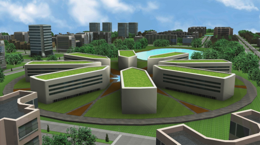
As part of advance planning for this dreaded event, the Istanbul city government commissioned a team at Purdue University led by Nicoletta Adamo-Villani and Mete Sozen to design and visualize a satellite city.
Their plan includes a business district, research and government centers, retail and cultural facilities, with all construction earthquake resistant.
After the team created the city plan in AutoCAD and modeled the city in Maya, a major challenge was to render the final sequence by their deadline.
To accomplish this, they relied on TeraGrid software called TeraDRE (Distributed Rendering Environment on the TeraGrid) and a TeraGrid cluster of 4,000 PCs spread across the Purdue campus.
